


w101
Death Valley
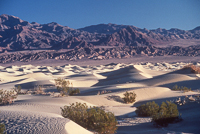
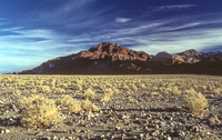
The name is more than a little deceiving. While Death Valley may be an incredibly inhospitable land for humans, it is home to a large population of wildlife, most of which are nocturnal in order to escape the desert’s daytime heat. And though they aren’t always readily visible, over 900 different species of plants live in this dry land. Just let a little of Death Valley’s 1.7 inches of annual rainfall sprinkle the valley and nearly overnight a profusion of desert wildflowers springs to life.
Death Valley is not one of those quick side trips you can take off the main highway. The first time I ventured into Death Valley, it was near dusk, when we turned onto Highway 190 from Lone Pine, having left the recently fallen snow that had dusted Highway 395 and the mountains to the north. About a dozen miles from Lone Pine, there’s the old abandoned Sierra talc mill at the small desert community of Keeler. It sits adjacent to dry Owens Lake. It warranted a few photographs just before the sun set behind the great wall of the Sierra Nevada to the west.
It’s about 60 miles from Lone Pine to the park, and another 25 miles to Stovepipe Wells. What begins as a relatively straight highway is soon a twisting, narrow black asphalt ribbon winding first over the mountains of the Argus Range and then over the Panamint Range. During daylight, this is an enjoyable trek. In the absolute blackness of a moonless night sky, the sudden turns required to avoid plunging down into a series of black abysses, keep the adrenalin level unusually high. Needless to say this road is one that should be driven slowly during the day in order to better enjoy the surrounding desert landscape, and at night driven slowly for reasons of survival.
Getting into this national monument is often the biggest adventure, especially for those few people who choose to visit here during July and August when daytime temperatures average 116° F. There is a long climb that begins at the base of the Panamint Mountains soon after leaving the desert community of Panamint Springs. For vehicles prone to overheating, water tanks are set along side the road at several locations for such emergencies.
The best time to visit Death Valley is from November to March when daytime temperatures average between 65°F to 80°F, and drop into the 30s and 40s at night. By May, daytime temperatures are hovering back around the century mark. Many services in the park are limited from May to October.
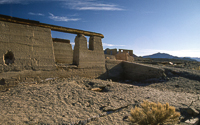
Why would anyone come to Death Valley? Initially, people came looking for minerals that would make them rich. In 1881, Aaron and Rosie Winters discovered borates on the valley floor and for $20,000 sold their claim to William Tell Coleman. Coleman’s venture, the Harmony Borax Mining Company, constructed a borax processing plant in Death Valley in 1883.
Coleman employed a mixed ethnic group of about 40 employees who produced three tons of processed borax each day. The process required boiling the raw “borate mud,” along with a type of soda, then siphoning away the borax-rich top layer. As it cooled, pure, crystallized borax formed on metal rods, which were then scraped clean of the finished product.
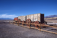
Getting the borax to market was one of the biggest challenges that faced these “white gold” miners. The nearest rail head was at Mojave, 165 miles away. The famous 20 mule teams (generally 18 mules and two horses) handled the transportation. Pulling two wagons, each capable of carrying tons of borax, and a 1,200 gallon water tank, it took the teamsters 10 days to make the trip to Mojave.
In the late 1880s, Coleman encountered financial problems and sold the Harmony Borax Mining Company to Pacific Coast Borax. The Harmony processing plant was never reopened. Pacific Coast Borax later changed its name to U.S. Borax and sponsored television’s Death Valley Days, the long-running series (1952-1970) hosted for two of those years (1964-65) by Ronald Reagan before his successfully move into politics.
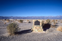
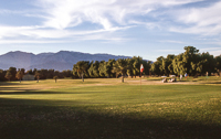
The remnants of the old Harmony Borax works can be toured near the Furnace Creek Visitor Center. Furnace Creek, located near the geographic center of Death Valley, offers the majority of visitor services in the park, from a golf course and hotel accommodations, to camping and museums.
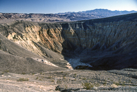
Much of the park is accessible via passenger vehicles, although many miles of dirt roads, some requiring 4-wheel drive vehicles reach some the more remote areas. At the far north end of Death Valley, not far from famous Scotty’s Castle, one fork of the paved highway ends at Ubehebe Crater. The crater, which measures 2,400 feet in diameter, was formed by a volcanic eruption 1,000 years ago. Little Ubehebe crater lies nearby. A trail leads around much of the rim.
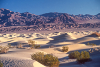
South of Furnace Creek, just off Highway 190, is Zabriskie Point. From the parking area there is an overlook that offers a spectacular view of some of Death Valley’s most beautiful geologic formations. The palette of artist colors and geographic formations make Death Valley a painter and photographer’s playground.
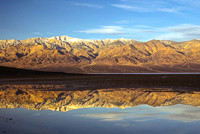
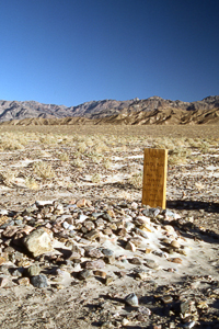
About 12 miles south of Furnace Creek on Highway 178, is a one-way loop road entrance, appropriately named Artists Drive, that circles through a short stretch of colorful canyons and badlands. Continue south on Hwy 178 for another eight or nine miles to Badwater, the lowest spot (282 feet below sea level) in the United States. Early morning light makes for beautiful photographs with the distant snow covered mountains reflected in the shallow water.
It can take several days to see all the major points of interest in Death Valley. Sites such as Wildrose, Mahogany Flat, Telescope Peak, Devils Cornfield, Devils Golf Course, Dantes View and the Ashford Mill ruins, are located over an area one-and-a-half times the size of the state of Delaware. Many of the roads are narrow and winding, and the motorhomes and trailers the come here can slow traffic even more. But slow is best way to fully enjoy this desert environment.
Because this is a desert, be sure that you always carry plenty of extra water (a gallon per-day per-person) and food. Your vehicle should be in excellent mechanical condition and always have a spare tire, especially if traveling on any of the dirt roads. If your car breaks down, stay with it. It is much easier to find a large vehicle in the desert than a lone person.
There are hundreds of old mines scattered throughout the park. Don’t enter any mine shaft, and watch children carefully. Some mines are nothing more than partially hidden, very deep holes in the ground.
Watch for rain threatening weather. Even a quarter inch of rain from a summer thunderstorm can bring devastating flash floods down narrow canyons.
For more information: www.NPS.gov
Visitor Center: (760) 786-3200
Camping: The reservation phone number is 1-877-444-6777 www.recreation.gov.
The Furnace Creek Campground is the only National Park Service (NPS) campground in Death Valley that takes advance reservations on the Internet or by telephone. Reservations can be made for the camping season of October 15 through April 15. Furnace Creek Campground reservations can be made six months in advance. Group campsite reservations can be made 11 months in advance. All other NPS campgrounds are first-come-first-served.
There are several campgrounds in the park, and all but the main campground at Furnace Creek are available first-come, first-served. None offer RV hookups. For room information call the Furnace Creek Inn at 619-786-2361.
Copyright 2015 by Publishing Syndicate, all rights reserved.
For permission to reprint text or photos contact Ken@PublishingSyndicate.com
Photos
Coming
Soon
w102
Red Rock Canyon
Vibrant shades of yellow and red are more closely associated with autumn leaves than with geologic formations, but such is not the case at Red Rock Canyon State Park. Set in the Mojave Desert near the western terminus of the El Paso Mountains, the park is a great place to experience some of Southern California’s desert geology.
Red Rock Canyon’s Wild West appearance, at least from Hollywood’s often unique perspective, has brought film crews to the park for years. More than 130 movies have been shot within the park, including most of the old Buck Rogers westerns. More recently the park has been popular for advertisers shooting their automobile and other product ads. But, if you look closely at the opening archeology camp scene in the original Jurassic Park, you’ll discover that it too was shot in Red Rock Canyon.
For the more scientifically inclined, the 27,000-acre desert park’s cliffs are comprised of layers of ancient non-marine sandstones and siltstones, lava flows and ash beds. Wind, rain and stream erosion have carved long, vertical columns in the softer stone. Considering that this area is now a desert, the discovery of petrified wood from pines, cedar and fig trees that once grew here, and the fact that Red Rock and Last Chance canyons were once part the shoreline of a large lake, help prove that earth’s climate has changed significantly over the past several million years.
The park’s rock formations reveal the fossils of camels, primitive horses, mastodons, and saber-toothed tigers. Today, coyotes, bats, mice, lizards and snakes, along with many birds, including roadrunners, inhabit these same cliffs and the desert floor. Those familiar trees that once grew here were long ago replaced with Joshua trees, creosote bushes and a profusion of colorful spring wildflowers—assuming the rains come.
Red Rock’s natural springs became a vital desert oasis for stage coach and freight wagon operations. And while California’s settlers generally passed through desert regions as quickly as possible, opting instead for more fertile valleys where water was readily available, the 1890s brought miners to the area. A few, such as Rudolph Hagen, even managed to strike it rich developing some of the area’s gold, silver and copper mines.
The same reason that most settlers shunned Red Rock Canyon and why visitors today generally avoid the park during summer are the temperatures, which can reach well over 100 degrees for days on end. The other three seasons, especially spring, are more popular visiting times, especially if desert hiking and exploring are of interest. “Off-season” daytime temperatures can be quite pleasant, with nights dipping to below freezing and snow an occasional caller. The periodic rains that seldom drop much more than six-inches of precipitation per year here, often come in short deluges, filling dry canyon washes quickly.
For those camping in one of the park’s 50 primitive campsites, there is much to explore. Dirt roads lead to many areas of the park, and four, short hiking trails, some marked with interpretive signs, help tell the story of this beautiful desert. Just remember to carry lots of water when heading into the desert, and if driving, stay on designated roads.
The park’s visitor center is open on weekends during summer and most everyday during the remainder of the year. Besides its exhibits, movies that were filmed in the park are shown on some weekends.
The park is located 25 miles northeast of Mojave on Highway 14 and its 50 primitive campsites are always available first-come, first-served. For more information call 661-942-0662.
Copyright 2015 by Publishing Syndicate, all rights reserved. For permission to reprint text or photos contact Ken@PublishingSyndicate.com

w103
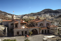
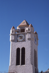
Scotty's Castle
A visit to Death Valley National Monument would not be complete without a drive to the north end of the park for a tour of what is popularly called Scotty’s Castle. While the “castle” never actually belonged to Walter Scott, better known as Death Valley Scotty, certainly Scotty and the castle became inseparable.
Walter Scott was born in Kentucky in 1872. His childhood dream was to go west and become a cowboy, and he didn’t wait long to fulfil that dream. At the tender age of eleven he ran away from home and traveled to the Nevada Territory to develop his wrangler skills. Two years later he found himself as a laborer at the Harmony Borax Works in Death Valley.
Rather than being driven away by the horrendously hot days in Death Valley, Scotty fell in love with this vast land. Even when he decided to leave the borax works for Idaho-Wyoming Territory and continue his cowboy dream, Scotty vowed to return to his beloved desert.
In 1890, Walter Scott found himself playing the ultimate cowboy role: performing as a cowboy in the Buffalo Bill Wild West Show. He spent a dozen years in show business traveling throughout the eastern United States and Europe.
Scotty’s skills as a huckster and promotions man were well developed by the time he left Wild Bill’s show. He used these skills, along with a couple of gold nuggets his wife had acquired in Colorado, to talk eastern investors into buying stock in his Death Valley gold mine. The front money allowed him to return to Death Valley, but he did no prospecting, spending the money instead in numerous towns, enjoying life.
During this time, Scotty’s flamboyancy and unique story telling skill made him moderately famous, at least famous enough to arrange a meeting with Albert Mussey Johnson. Johnson was from Chicago and had become a multi-millionaire in the insurance business. Scotty talked Johnson into a grubstake, which led to more requests for money with never any return on his investment.
Probably much to Scotty’s consternation, Johnson decided to visit the secret gold mine. Scotty put Johnson on a mule and showed him all the sights of Death Valley, except of course the nonexistent gold mine. Eventually, Johnson figured out that Scotty’s gold came from other people’s pockets, but his generally poor health had improved so much in the dry desert air that the gold no longer mattered. Johnson, a nonsmoking, nondrinking, non-cussing religious man, enjoyed Scotty and his wild ways.
Johnson enjoyed his improved health, along with the weather, beauty and solitude of Death Valley so much, that, he returned often. With a little persuasion from his wife Bessie, he decided to buy land and build a vacation home near Grapevine Canyon. A mining engineer by training, until an accident sent him into the insurance business, Johnson took a special interest in the design and construction of his home.
Grapevine Canyon, where in the late 1880s, a German immigrant had established a successful grape, fig and vegetable farm, was carefully selected because of its adequate water supply. One spring provided 200 gallons of water per minute.
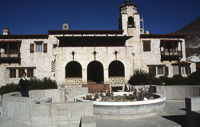
Construction on the elaborate Spanish Provincial home began in 1925. With the exception of rock, gravel and water, nearly everything had to be brought into Death Valley for Johnson’s new home, including the Pelton waterwheels. From the primary water source up Grapevine Canyon, Johnson constructed a pipeline that provided 95 PSI of pressure to turn a Pelton waterwheel and a 7.5 kilowatt General Electric generator, producing 110 volts of direct current electricity. A series of batteries stored the generated power, providing the castle with ample electricity 24-hours a day.
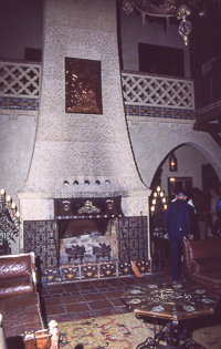
Spring water was also used to cool the house. Two large fountains were constructed in the main house that allowed water to trickle into open pools. Evaporating water added humidity to the dry desert air, cooling the home’s interior. The hot desert sun was used to heat water for the kitchen and bathrooms. A solar hot water heater was constructed behind the castle, its 960 feet of alcohol-and water-filled copper tubing heating water in the storage tank.
Following some initial basic construction, Johnson asked famous architect Frank Lloyd Wright to redesign his desert home. Wright visited Death Valley quickly becoming infatuated with desert landscape. He presented Johnson with plans for low-lying structures, built of native materials, that would blend into the surrounding landscape. Johnson rejected the plans; he wanted something more conspicuous and befitting a man of his wealth.
When the stock market crash of 1929 hit, Johnson lost most of his money. Two years Johnson stopped work on his ranch, leaving some projects incomplete and others never started. Albert and Bessie Johnson continued to visit the ranch for several weeks each year, and they also allowed Scotty to live at the ranch.
Scotty never missed an opportunity to promote his gold mine. He began telling everyone, newspaper reporters included, that the ranch was his and gold from his secret mine was paying for all the construction. Johnson enjoyed Scotty’s stories, and allowed the scam to continue. As a result, newspapers and magazines began calling the ranch Scotty’s Castle, and the name has stuck.
When asked why he allowed Scotty to continue with his extravagant claims, Johnson replied, “Scotty repays me in laughs.” Johnson died in 1948 and Scotty died six years later.
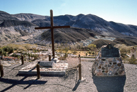
Scotty’s castle is open daily for tours. It is best to arrive early and expect to wait for one or two hours to get on a tour, especially on busy holiday weekends. While waiting, there is a gift shop and snack bar. There is also a trail that leads up the hill behind the castle to where Scotty is buried. The overlook offers a wonderful view of the castle and the surrounding hills.
The castle is open all year with tours from 9AM to 5PM. During busy holiday periods, the ticket office may open earlier (8:10AM) with tours beginning at 8:30AM. Cost is $6 for adults and $3 for kids and seniors. For information about Scotty’s Castle or Death Valley National Monument call the ranger office at (619) 786-2331.
Copyright 2015 by Publishing Syndicate, all rights reserved.
For permission to reprint text or photos contact Ken@PublishingSyndicate.com
w104
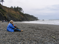
Patrick's Point
State Park
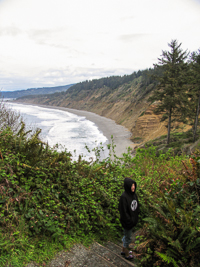
Tectonic plate movements, geologic uplifting, and many thousands of years of erosion have combined forces and created headlands along the length of California. Patrick’s Point is one of the more prominent of the many headlands that separate rocky cliffs and long sandy beaches. One of the favorite destinations at Patrick’s Point is Agate Beach. The waves wash a constant supply of small agates onto the beach gravels which visitors enjoy collecting. Access to the beach can be a challenge for many and may be impossible for those unable to negotiate the steep and long set of wooden stairs that drop from the top of the bluff trail to the sandy beach below.
Within the park sightings of black tailed deer are common, especially along the bluff and in the open meadow near Ceremonial Rock, which is actually an ancient sea stack that was left high and dry following the rising of the land. It’s located near the center of the park. Another ancient sea stack, Lookout Rock, is located just off Rim Trail, near the hike and bike campground.
A good place to begin either a quick, single-day exploration of some of the park’s more prominent features is at the new visitor center, which is located near the park entrance. Exhibits and information are available that will enhance anyone’s visit, including how to identify the agates on Agate Beach.
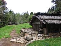
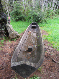
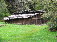
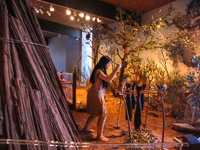
Sumêg Village, just a short walk from the visitor center, is a reconstruction of a Yurok Indian village. The Yuroks’ redwood shelters served critical roles in their lives. They believed that the redwood planks were spirits and that their shelters actually lived. Yuroks gave their houses names, and each family’s loyalty was its home, rather than to the tribe.
Beginning in 1990, in much the same traditional manner as was done for thousands of years, local Yurok Indians came together and used stone mauls and wedges to split the redwood planks for their reconstructed village. Inside the low-built homes, pits 4- to 5-feet deep increased living space inside. Today, the village remains in use for special Yurok ceremonies and events, but is it open daily for anyone to wander through.
The Yurok maintained a distinctive class system that was obvious within the ceremonial clothing worn by the women. The aristocrats of a Yurok village would often provide the regalia worn by all the dancers at many ceremonies, clothing adorned with various shells seen as valuable within their culture, such as olivella, butter clam, cockles, dentalliam, and red abolone. Even more rare and valuable were the women’s dresses made from the skins of albino deer.
Like most public and private lands throughout northwest California, black bear, black tailed deer, and raccoons are always around. Along the park’s rocky, southern shoreline, tide pools are a cold, inviting haven for dozens of different animal species, from mussels and oysters to sea stars and anemones. Sea lions, once prey for Yurok hunters, bark their incessant calls from the offshore rocks. If you’re interested in fishing, there’s plenty of both rocky and sandy shoreline to be found within the park. During certain times of the year various fish species migrate to their spawning areas located close to shore, offering anglers the opportunity to regularly catch ling cod, greenlings, sea trout (steelhead), and cabezone.
With an average of 65 inches of rain each year, the is provided plenty of moisture for the tremendous variety of plants found here. Sword ferns and redwoods are common and easily identified, but spruce, hemlock, and Douglas fir are also prevalent within the park’s boundaries. In the open meadows and along the forest trails, spring and summer bring a plethora of wildflowers, such as Douglas iris, rhododendrons, fairy bells, false lilies-of-the-valley, and the ever-present berries—blackberries, salmon berries, thimble berries, and huckleberries.
Directions: From the town of Trinidad, drive 6 miles north on US 101 and take the Patrick’s Point Drive exit and follow the road to the park entrance. As an alternative, Patrick’s Point Drive parallels the west side of the US 101 freeway from Trinidad.
Activities: Camping, hiking, fishing, beachcombing.
Facilities: Campground, visitor center.
Dates: Open year around.
Fees: Camping and day-use fees.
Closest town: Trinidad, 6 miles.
For more information: www.parks.ca.gov or Patrick’s Point State Park, 4150 Patrick's Point Dr. Trinidad, CA 95570. Phone (707) 677-3570.
Trails
Patrick’s Point State Park has several miles of trails that connect the coastal beach on this small peninsula with inland areas, including park headquarters, the visitor center, Ceremonial Rock, and the several campground loops.
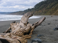
Rim Trail: Most of Patrick’s Point State Park lies on a bluff 100 feet above the ocean beach. The Rim Trail leads around the park’s coastal perimeter and has six, steep but negotiable 0.25 mile trails that lead to the water’s edge. The coastal views are great nearly anywhere along the trail, which leads hikers to such special places as Wedding Rock, Patrick’s Point, and Palmer’s Point. Abalone Point, another side trail, is one of the more popular places to watch gray whales during winter. It’s also a place to wander among the jagged coastal rocks and piles of driftwood that winter storms deposit along the shore. Rim Trail begins near Palmer’s Point on the south end of the park, and after about 2 miles ends at the Agate Beach parking lot on the north end of the park.
Agate Beach Trail: This trail is only about 0.25 mile long, with and the last portion being a steep stairway. The beach is long and wide and is a great place to explore. One reason people wander this beach is to look for agates. The ocean waves constantly move the gems on and off the sandy beaches, polishing the semi-precious stones and making them wonderful finds. As always, use caution whenever exploring near the surf line, especially if there are high waves. The water is cold and the rip currents can be extremely strong. Rogue waves have been known to sweep unsuspecting people off the rocks or from the beach.
Octopus Trees Trail: This 0.25 mile loop trail leads to a stand of Sitka spruce where, over the years, many of the trees’ roots have grown over fallen logs, most of which have since rotted and disappeared back into the soil. What’s left are tentacle-like roots that loop away from their trunks. The trail is only a 0.25 mile round trip.
Black Bears
Black bears are common in redwood country. In many areas where people congregate, they can become nuisances or even more dangerous than normal. Always remember that all bears are wild and that their primary goal is to eat. Wildlife managers generally must destroy bears that make a habit of wandering into campgrounds and ripping open car doors and breaking apart ice chests for food. They can smell food odors even inside cars.
Do not make food available to bears or any wild animal. If camping, store food in airtight containers locked in your car’s trunk or in bear-proof storage lockers that may be provided in park campgrounds. If backpacking, store food over tall tree branches out of their reach. And always dispose of garbage in bear-proof trash cans. REMEMBER: A FED bear is a DEAD bear.
Copyright 2015 by Publishing Syndicate, all rights reserved.
For permission to reprint text or photos contact
Ken@PublishingSyndicate.com
w105
Fort Stevens
Only one defense installation on the continental United States has come under enemy attack since the War of 1812. That distinction belongs to Fort Stevens, located on the Oregon side of the Columbia River, which was shelled by a Japanes submarine on June 21, 1942. The inaccurate firing from the sub caused no damage or casualties and because it remained out of range of the fort’s considerable defensive firepower, the soldiers manning Fort Stevens never returned fire.
The Civil War provided the initial impetus for the United States to construct a fort at the mouth of the Columbia River. Fear existed that the West Coast was vulnerable to attack from British and Confederate sea raiders, so in 1863, President Lincoln ordered the construction of coastal and harbor defenses. The original gun emplacements, complete with a moat and drawbridge, were located at Point Adams. The five-sided earthworks were designed to protect the Oregon side of the the mouth of the Columbia River. The fort was completed in 1864, and outfitted with 26 guns, including seventeen 10-inch, smoothbore Roadman cannons, each capable of firing a 128-pound cannonball over a mile, and each of which required a gun crew of 17 men to operate.
After the end of hostilities between the Union and Confederacy, little effort was made to maintain Fort Stevens, and as a result, between 1986 and 1904, a major renovation of the fort was required. Extensive reinforced concrete fortifications that housed eight separate gun batteries were constructed. One battery was constructed inside the original earthworks. By 1920, all the guns were removed from the earthworks, which in 1940 were leveled into a parade field. Today, restoration of the old earthworks gun emplacement is underway.
Other than the attack by a lone Japanese submarine and occasional practice, Fort Stevens saw little action. During World War II, the fort served as a training area, in addition to fulfilling its role of protecting the Columbia River mine fields. During World War II as many as 2,500 troops were stationed here, mostly Oregon State National Guard soldiers. The fort was abandoned after the war ended, the guns were removed and most of the fort’s buildings were razed.
The Oregon state park system acquired the 3,800 acre Fort Stevens in 1976 and began the task of removing the sand and vegetation that had overgrown the extensive series of gun batteries. They also contstructed a beautiful campground and day use areas complete with hiking and paved bicycle trails, ocean beach access, and swim beaches on Coffenberry Lake which lies within walking distance of the campground.
The historic areas are located at the northern entrance to the park. The Fort Stevens Military Museum and Interpretive Center is a good starting point for exploring the old gun emplacements. There is a short film showing the firing of the 10-inch disappearing rifles during 1941. Walking tour brochures and other publications are available in the museum. Outside is a WWII-era anti-aircraft gun, 155mm GPF artillery piece, along with other military equipment. A Civil War camp area has also been set up, with demonstrations of musket firings during the summer.
Battery Lewis is a very short walk from the military museum and is great fun to explore. Unlike most states, especially California, the old concrete gun emplacements have not been fenced off as being too dangerous. You can climb the old ladders and wander through powder storage rooms and observation towers. Do be careful and watch smaller children. A fall from some of the higher, open walls could result in very serious injuries. The WWII guns were removed and scrapped by the military in 1947. Other than those on display at the museum, the only artillery pieces remaining are the 5-inch navel guns at Battery 245, which is located a short walk beyond Battery Lewis. They replaced the 6-inch anti-aircraft guns that were here during WWII.
Campground with 262 tent sites, 130 electrical hookup sites, and 213 full hookup RV sites.
Copyright 2015 by Publishing Syndicate, all rights reserved.
For permission to reprint text or photos contact Ken@PublishingSyndicate.com
Photos
Coming
Soon

w106
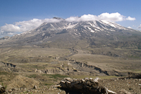
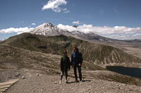
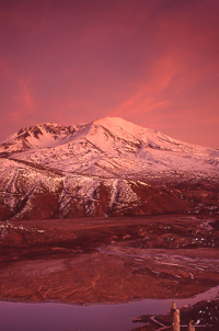
Mount St. Helens
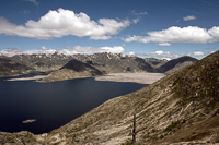
May 18, 2015 marks 35 years since one of the most beautiful and symmetrical volcanoes in Cascade Range dramatically exhibited nature’s imponderable power to the world. That quiet Sunday morning in 1980, Washington exploded into history as an otherwise moderate earthquake (5.1 on the Richter scale), collapsed the mountain’s already bulging and weakened north side, releasing superheated ground water and melted rock.
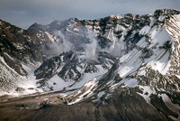
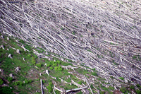
Within minutes a chain of events devastated 230 square miles of forest, mountains, lakes and rivers. Superheated winds of 670 mph leveled and incinerated everything in their path, including enough timber to build nearly a half million homes. The blast melted glacial ice creating massive mud slides that roared down the mountain at 150 miles per hour blasting the waters of Spirit Lake 800 feet up the side of an adjacent mountain. It filled the lake with volcanic debris, creating a new lake 206 feet above the old.
Charged with super-heated rocks and trees ripped out at their roots, mud slides careened along several valleys as they followed the topography. One slide surged down a valley and over another 1,150 foot ridge, finally ending its destruction in South Coldwater Creek. Another portion of the landslide carried 15 miles down the North Fork of the Toutle River filling the valley to an average depth of 150 feet–640 feet at its deepest point. The super-heated cement-like mixture of volcanic soil and water smashed homes, bridges and railroad cars and killed thousands of fish. As the volcano’s debris poured down tributary rivers, it nearly blocked the huge Columbia River.
As mud slides were destroying the forest and rivers, a column of ash and pulverized rock rose 12 miles above the spewing volcano. Winds quickly spread the airborne ash, turning eastern Washington’s morning into night.
The initial eruption incinerated and buried untold thousands of bear, elk, deer and other wildlife. It also killed 57 people, including the owner of the St. Helens Lodge, old Harry Truman. For weeks, as a suddenly awakened Mount St. Helens rumbled its early warnings, Harry had become something of a celebrity when his refusals to leave his home on Spirit Lake were aired by nationwide radio and television news. Other victims included fishermen, campers and photographers who ignored warnings to stay away from the area.
The volcano lies relatively quiet now, only occasionally spewing steam and smoke. Its last real activity was in 1986 during a dome building period. But nature has replaced only about 7 percent of the original mountain with new outpourings of thick lava during such sporadic active dome-building periods.
Today, thousands of people tour the devastation that is still very visible around Mount St. Helens. It is possible to see much of the area on a long, one-day, 200-mile drive around the mountain, although it is easy to spend several days enjoying the area, especially if fishing is on your itinerary. Rivers such as the Toutle and Cowlitz, that were once filled with volcanic debris, are once again alive with trout and steelhead. It’s a good idea to start with a full gas tank because services are limited around the mountain. The entire loop requires about six hours of actual driving time.
For first-time visitors, one of the best place to begin your tour while gaining a better understanding of the volcano is at the Mount St. Helens Visitor Center. The center is located on the Spirit Lake Memorial Highway (Exit 49/Hwy 504) off Interstate 5 at Castle Rock. The visitor center is located about five miles from the freeway. On clear days, there is a beautiful view of the distant volcano, and inside the center you can walk down inside a replica of Mount St. Helens, or watch a dramatic audio-visual show that replays the fury of the mountain on that May morning. There is a large selection of publications, including tour maps of the mountain, while volunteers and staff provide information such as where camping are located.
The best close-up viewing area is on the northeast side of Mount St. Helens along Windy Ridge. A paved road (Hwys 25 or 26 to Hwy 99) leads up the ridge. There are numerous turnouts and parking areas as the road passes forest lands devastated by the volcano. A dozen years after the event, wildflowers, shrubs and a few small trees are beginning to be seen among the tangled maze of blown-down trees.
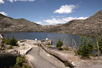
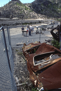
Inside the blast zone, near the intersection of Highways 26 and 99, lie the flattened remains of a car that belonged to three people killed in the eruption. Nearby is a short trail that leads to Meta Lake. Shielded from the direct blast by a ridge and covered with a thick layer of ice and snow, Meta Lake is one of the few areas in the blast zone that escaped relatively unscathed. Today, trout and frog eggs that survived the volcanic blast form the basis of life that teems in and around the lake.
It’s still another few miles to where the road ends at the Windy Ridge overlook. From the overlook the view inside the volcano is more than spectacular, even though the center of Mount St. Helens is still about three miles in the distance. Also at the overlook, there is a small amphitheater where rangers give talks during summer afternoons about what happened to Mount St. Helens on May 18, 1980, and what is occurring to the volcano and surrounding lands today. There is a fairly steep stairway-like path that leads up to the top of the Windy Ridge where there are wonderful views of the “new” Spirit Lake and the surrounding landscape. True to its name, the ridge is generally windy and chilly, even during summer.
For those who want to get even closer to Mount St. Helens, climbing permits can be obtained from one of the visitor centers. Only 100 permits are issued each day during the summer season, May 15 through October 31, and most are obtained in advance by mail (up to 70 by mail with 30 for “walk-ins”). About 16,000 people registered during the 1990 season, making Mount St. Helens second only to Japan’s Mount Fuji as the most-climbed mountain in the world.
Although the climb is more of a steep hike, most often get into trouble because they don’t come prepared for the cold and wet conditions that can move in very quickly. Hypothermia and exhaustion are easy to encounter on any of several routes to the top, and early in the season, be prepared for considerable snow and ice on the trails. Most climbers start at the end of Road 8100.030 at an elevation of 3,700 feet, then hike another 5.5 miles to gain the additional 4,700 feet to the top.
Families looking for a considerably less arduous exploration can stop at Ape Cave located about two miles north of Highway 90 near the west end of Swift Lake. Ape Cave is actually the longest known lava tube in North America. If you don’t have your own flashlight (and preferably a backup light), lanterns can be rented for a nominal fee at the small visitor center. You can either explore the lava tube on your own or wait for one of the ranger-led tours that are held daily during the summer season.
For a packet of information about camping in the area or climbing the volcano write to: Mount St. Helens National Volcanic Monument, Route 1, Box 369, Amboy. WA 98691 or call 206-247-5800. The Castle Rock Visitor Center can be reached at 206-274-6644.
Copyright 2015 by Publishing Syndicate, all rights reserved.
For permission to reprint text or photos contact Ken@PublishingSyndicate.com
w107
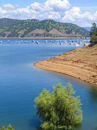
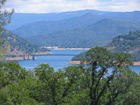
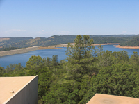
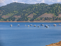
Lake Oroville
When summer’s heat sends all life in the Central Valley scurrying into air conditioned malls, Lake Oroville State Recreation Area offers a cool respite in the great outdoors. At full pool the waters locked behind the the earthfill dam cover over 15,000 acres and offer 167 miles of shoreline to boaters,swimmers, fishing enthusiasts, picnickers, campers, equestrians and hikers. While a boat allows the freedom to explore all of Lake Oroville’s shoreline, roads offer the boatless great access to numerous recreation spots around the reservoir.
When completed, Oroville Dam was the tallest and one of the largest earth-fill dams in the world. It took more than 80-million cubic yards of gravel to create the 770-foot tall dam. The builders of the dam didn’t have far to search for their gravel fill. Dredges from last century’s extensive gold mining operations along the Feather River had left behind plenty of gravel tailings.
A great place to begin your visit, especially if it your first time to explore the area, is at the Visitor Center located at the end of Kelly Ridge Road, not far from the dam. Besides being situated atop Kelly Ridge for a great overview of the lake and dam, it houses numerous exhibits on the park’s diversity of flora and fauna. And, additional exhibits and a short film help tell the story of how and why this huge dam was built at the confluence of several forks of the Feather River. A hint? power, which is housed in an area the size of two football fields, carved from solid bedrock. Besides its maximum generating capacity of 678 kilowatts of clean, hydroelectric power, enough to light all of Sacramento and Oakland, Lake Oroville is the starting point for much of the water shipped south via the California Aquaduct, some of it ending up some 600 or so miles south behind another dam at Lake Perris State Recreation Area.
But you don’t come to Lake Oroville to spend time in a visitor center. If you’ve come trailing a boat behind your vehicle, several choices for launching are available. Drive across the dam and you will be greeted by a 13-lane launch ramp, so there shouldn’t take long before you’re on the water. Just don’t forget you PFDs (personal flotation devices--life jackets), water to drink and sunscreen to protect your body. If you happen to be driving an RV and don’t need hook-ups, you can spend the night here also. If you need a few more services, like gas, food and fishing supplies, then the marina, located just off Kelly Ridge Road, is probably a better choice.
If you’ve come to camp, and it’s always better to spend two or three days, or longer, then there are several boat-in primitive campgrounds around the lake. If you’re not into “primitive” camping, then the floating campsites might just be your cup of tea. At least you’ll have the benefit of not having to sleep in a tent on the ground. Actually, these anchored house boats offer a great base from which to explore the rest of the lake, especially if you have friends or kids or other family members whose stomachs aren’t as fond as you might be of zipping around in a boat all day. They make great platforms for swimming or fishing--or just sitting back enjoying a good book and the warm sun.
Those sans boat, but with camping equipment or picnic baskets can head to Loafer Creek where 137 family campsites and 100 picnic sites are tucked in the shade under the park’s beautiful oak trees. During summer it’s always a good idea to have camping reservations or you’re likely to go away disappointed (call 1-800-444-7275 for camping reservations). Loafer Creek is also a great place to swim. There’s a sandy beach where Loafer Creek empties into the lake.
Fishing is one of those summer activities that remains among the most popular, practiced and frustrating pursuits ever invented, with maybe the exception of golf. At least you can eat a fish, should you catch one. And that generally isn’t all that difficult even though Lake Oroville is the largest of the state water project reservoirs, with more than 3.5 million acre-feet of water for fish to hide in. But, both shore and boat fishing regularly proves successful. The reservoir offers both large and small mouth bass, with a good population of rainbow trout, which the Department of Fish and Game replenishes regularly. A fishing license is required for those over 16 years old, and there are limits on the numbers of wriggly creatures you can attach to your stringer or stuff into your ice chest. Check the current California fishing regulations for more information.
Copyright 2015 by Publishing Syndicate, all rights reserved.
For permission to reprint text or photos contact Ken@PublishingSyndicate.com
w108
Lost Coast
California’s Lost Coast is an area of only a few, narrow paved roads, a few more miles of dirt roads that in places create challenges for anything less than four-wheel-drive vehicles, and many more miles of hiking trails. It includes the incredibly rugged King Mountains, isolated on a piece of coastline that bulges out into the Pacific, west of Garberville and US 101. The San Andreas fault lies just offshore, marking the rift that separates the Pacific plate and the North American plate. The ancient and continuing tectonic movements also make the Lost Coast’s mountains some of the most geologically active in the country. During the past 6,000 years the King Range has risen 66 feet.
The mountains aren’t the only things active here. The Lost Coast can receive 100 inches of rain during “dry” winters and twice that amount during “wet” winters. All this rain running down streams and rivers has severely cut the mountains, creating steep cliffs, lots of sliding slopes, and thick forests.
There is little private property, especially within the thousands of acres that stretch down the coast. The most notable nonpublic land is the small town of Shelter Cove, which effectively separates the King Range National Conservation Area on the north from Sinkyone Wilderness State Park and 3,800 acres of Trust for Public Land property on the south.
But, even though the Lost Coast is a relatively wild area free of human inhabitants today, this has not always been the case. In the 1850s, probably 6,000 years after the first Indians arrived here, American settlers entered the mountains, bringing sheep and cattle to graze in the meadows and forests. They were soon followed by men looking for oil and who were successful in finding it. Although not a high-profit operation, they drilled California’s first oil well here in 1865.
During this same period, the centers of industry required a continuous supply of leather belts needed to run steam-powered factory equipment. Harvesters came to the mountains of the Lost Coast to strip the bark from tanoaks, which was needed in the leather harvesting process. Commercial fishing, based in Shelter Cove, followed, and then the loggers came. Even though logging continued in some areas of the Lost Coast as late as the 1960s, scattered forests of old-growth Douglas fir and redwoods remain.
For a few years, a railroad was operated from Bear Harbor. The rugged mountains of the Lost Coast were not the best choice for such a venture. The Bear Harbor and Eel River Railroad was designed to transport logs from the coastal mountains to Piercy, which lies on the Eel River. The beginning portion of the route from Bear Harbor was so steep that a winch was required to raise and lower the locomotive and cars during the initial leg of the trip. A storm destroyed the harbor’s pier in 1899, hampering the rail operation, and the railroad’s owner died in an accident in 1905. One year later, the great San Francisco earthquake severely damaged trestles and stretches of track, ending the railroad’s use. A few of the old rails remain today, rusting in the damp, salt air.
SHELTER COVE
The easiest and fastest route into the Lost Coast is to drive west out of Garberville, through Redway to Shelter Cove. Shelter Cove Road is paved but narrow as it winds through the forest and over the coastal mountains. Dropping down from the summit into the surprisingly large community of Shelter Cove, it offers wonderful views of the rugged mountains that surround the aptly named town. There is a miniature maze of subdivision-like streets that wind around the area and a substantial number of mostly vacation homes scattered along the hillsides and across the flat meadows that once fed cattle and sheep and served as staging areas for harvested timber.
In the main cove at the end of Machi Road, there is a public beach with restrooms and a boat launch facility. Little Black Sand Beach is another popular spot and is located on the north side of the Shelter Cover community, off Beach Road. But many people who come to the Lost Coast are looking for more of a wilderness experience, and that’s easy enough to find in both the King Range National Conservation Area and in Sinkyone Wilderness.
Directions: From Garberville/Redway follow the signs west to the Shelter Cove/King Range National Conservation Area. Although the road is paved, it is narrow and twisting. Expect the 22-mile trip to take about 45 minutes.
Activities: Hiking, camping, fishing, boating, backpacking, beach exploration.
Facilities: Boat launch, marina, store, picnic area.
Dates: Open daily.
Closest town: Garberville, about 22 miles.
For more information: Shelter Cove Information Bureau, phone (707) 986-7069
KING RANGE NATIONAL CONSERVATION AREA
The conservation area ranges in elevation from sea level to the top of King’s Peak at 4,087 feet, the King Range’s highest mountain. The conservation area stretches for 35 miles, from the mouth of the Mattole River in the north to Sinkyone Wilderness State Park in the south, and ranges inland about 4 miles at its widest point.
Congress established the King Range National Conservation Area in 1970 and placed it under the control of the Bureau of Land Management. Within the conservation area’s 60,000 acres, old-growth Douglas fir forest serves as home to Cooper’s hawks (Accipiter cooperii) and bald eagles. Endangered spotted owls (Strix occidentalis) live in the canopy, while on the forest floor elk, black bears, and black-tailed deer feed on the grasses and shrubs.
In an earlier time, Mattole and Sinkyone Indians lived throughout the area, but they were forced to give up much of their traditional way of life when American settlers began arriving in relatively large numbers. During the 1850s, white settlers first came to graze cattle and sheep and were soon followed by the commercial fishing industry and finally by the timber harvesters. The lands were logged for decades, with some of the most intense logging activity occurring during the 1950s and 1960s. When the steep and unstable mountainsides were clear-cut, they eroded easily, creating massive land slides that choked the Mattole River and other waterways in the area. Now, major restoration programs are beginning to return forests to the once-stripped mountainsides.
The King Range offers an opportunity for both car camping and backpacking. There are campsites at the Mattole River mouth, which are the only drive-in sites on or near the beach. To reach the Mouth of the Mattole Recreation Site, from US 101, take the Ferndale Exit and drive 5 miles to the town of Ferndale. Continue on the same road through town and follow the signs to Petrolia. One mile past Petrolia, turn right on Lighthouse Road and follow it until it ends. It’s about 45 miles total, which will take about 1.25 hours to drive. The remaining car-accessible campsites are reachable via Mattole Road, which winds along the eastern side of the conservation area, generally following the Mattole River. They include A.W. Way County Park, which will accommodate tents and trailers along the Mattole River, and is located about 8 miles north of Honeydew, and Honeydew Creek, which has several creekside campsites for tents and trailers and is located about 1 mile south of Honeydew.
Most of the camping done in the King Range National Conservation Area is in trail camps or in the coast camps which are undesignated sites on or near the beach. Some of the more popular areas are near Cooksie Creek, Randall Creek, Big Creek, Big Flat Creek, Buck Creek, and Gitchell Creek. Each of the creeks crosses the Lost Coast Trail (see below) between the Mattole River in the north and Shelter Cove near the south end of the conservation area.
Directions: There are three access routes into the King Range National Conservation Area. From US 101, take the Ferndale Exit, and continue driving through Ferndale, following the signs to Petrolia. Lighthouse Road, which leads to the mouth of the Mattole River (5 miles), is 1 mile past Petrolia. Honeydew can be reached by taking the South Fork/Honeydew Exit from US 101. Follow the signs for about 23 miles to Honeydew, then bear left 1 mile to the Honeydew Creek Recreation Site. Plan on it taking at least 1 hour to travel the 24 miles. The southern access is from Garberville/Redway to Shelter Cove. Although the road is paved, the 22-mile trip will take about 45 minutes.
Activities: Hiking, camping, fishing, backpacking, beach exploration.
Facilities: Some campsites with picnic tables and pit toilets, trails.
Dates: Open daily.
Fees: There are camping fees.
Closest town: Ferndale, about 32 miles to the north and Garberville, 22 miles to the southeast, and Shelter Cove, which lies on the coast, adjacent to the conservation area in the south.
For more information: Bureau of Land Management Office, Arcata Field Office, 1695 Heindon Road, Arcata, CA 95521-4573. Phone (707) 825-2300.
Trails
There are more than 70 miles of trails lacing this mostly roadless land. With so many interconnecting trails, it is critical to have a topographic trail map of the area. An excellent map is available from Wilderness Press, 2440 Bancroft Way, Berkeley, CA 94704. Phone (800) 443-7227, fax (510) 548-1355. The map also is sold at numerous stores and visitor centers throughout the north coast, including Sinkyone Wilderness State Park, PO Box 245, Whitethorn, CA 95489 (phone 707-986-7711), and Arcata Resource Area, US Bureau of Land Management, 1695 Heindon Road, Arcata, CA 95521. Phone (707) 824-2300.
The Lost Coast Trail begins near the mouth of the Mattole River, then meanders inland and south for 3.2 miles, reaching the coast at the Punta Gorda lighthouse. From Punta Gorda the trail follows the beach reaching Spanish Flat after 5.2 miles and Big Flat in 7.5 additional miles. It’s another 14.1 miles before the conservation area portion of the trail connects with the Sinkyone Wilderness trail at Whale Gulch.
The King Crest Trail is 10.5 miles long, with the top of King’s Peak located at about the midway point. The trail begins in the north at the Smith Etter Jeep Road and North Slide Peak Trail It passes the Saddle Mountain Trailhead [Fig. 14(3)] near the south end, which leads back to Honeydew Creek tent camping area. The King Crest Trail’s southernmost trailhead begins at the King Peak Road, which leads to Shelter Cove.
Copyright 2015 by Publishing Syndicate, all rights reserved.
For permission to reprint text or photos Ken@PublishingSyndicate.com
Photos
Coming
Soon
w109
Mark Twain
and
Bret Harte:
Gold Country
Trails and Tales
Gold! They’ve found gold in California! Those magical words attracted a miserable assortment of wide-eyed and itinerant adventurers, fortune seekers, businessmen, horse traders, horse thieves, horses’ asses, gamblers, murderers, victims and fools. A few became rich, fewer became famous, and fewer still retained either fame or fortune beyond the first saloon stumbled into on their ignominious search for solace, celebration and a brief respite from self-imposed celibacy.
From this mishmash of humanity emerged two very different writers, each destined to record the aspirations, inspirations and consolations of early life in California’s gold country. Although Bret Harte and Samuel Clemens, or Mark Twain as he became better known, attained their initial writing fame during their relatively few years spent in California, both similarity and difference existed in their individual lives and in their writing styles. Harte labored with and mastered the more prevalent and accepted Eastern formal literary style and tended to espouse a stern Calvinistic moral code, while Mark Twain reveled in the more realistic crudeness of the West’s language and morality.
Bret Harte and Mark Twain marked their entries into the world literary scene with, The Luck of Roaring Camp, and The Celebrated Jumping Frog of Calaveras County, respectively. Harte’s propensity for writing in a more formal style, his inclusion of local color, and dispensing of moral platitudes is readily discernible in his description of Cherokee Sal’s “condition” in The Luck of Roaring Camp: “She was coarse, and, it is to be feared, a very sinful woman. Dissolute, abandoned, and irreclaimable, she was yet suffering a martyrdom hard enough to bear even when veiled by sympathizing womanhood, but now terrible in her loneliness. It was, perhaps, part of the expiation of her sin, that at a moment when she most lacked her sex’s intuitive tenderness and care, she met only the half-contemptuous faces of her masculine associates.”
On the other hand, Twain’s descriptive prose took Eastern condescending attitudes a bit longer to catch hold of and accept, such as with his description of Jim Smiley’s horse in Jumping Frog: “...and he used to win money on that horse, for all she was so slow and always had the asthma, or the distemper, or the consumption, or something of that kind. They used to give her two or three hundred yards start, and then pass her under way; but always at the fag-end of the race she’d get excited and desperate-like, and come cavorting and straddling up, and scattering her legs around limber, sometimes in the air, and sometimes out to one side amongst the fences, and kicking up m-o-r-e dust and raising m-o-r-e racket with her coughing and sneezing and blowing her nose and always fetch up at the stand just about a neck ahead, as near as you could cipher it down.”
Francis Bret Harte was the first Californian to successfully gain widespread recognition from the Eastern Establishment literary pundits. Although his sporadic formal education ended at age 13, parental influence saw to it that Harte was well read in Shakespeare, Dickens and other fine literature of the day. Harte was only 16 years of age when he followed his mother to California in 1854. His next few years were spent working and wandering the streets of San Francisco, interspersed with a one year excursion into the Mother Lode, where he began the assemblage of characters who would enliven his stories for the next half century. Gamblers, stage coach drivers, miners, robbers, whores, Indians, Chinese immigrants and Mexican laborers were all to see new life in Harte’s writings.
Unlike Harte, who knew from his early beginnings that he would become a writer, Samuel Clemens came to California searching for the elusive “elephant,” the literal pot of gold at the end of the rainbow. Unfortunately, discovering that pot required a goodly amount of hard, callous-raising, back breaking work and an even bigger allotment of luck, neither of which came easy to Clemens. He sold some early written sketches to the Territorial Enterprise of Virginia City as a way of providing a few more dollars for his mining ventures. Those sales led to the editor offering Clemens a job with a weekly salary of $25. Twain dropped his shovel, pick and pan, and in 1862, at the age of 26 years, gladly accepted the job in Virginia City.
Samuel Clemens had written under the byline of “Josh” before he ultimately adopted the pen name Mark Twain, a term he had known well as a Mississippi riverboat pilot. “Mark twain,” in the language on the river, signified two fathoms, or twelve feet of depth. A less accepted, yet more picturesque and possibly fitting story for his newly adopted name referred to Twain’s affinity for imbibing in drink, suggesting that the local bartender would yell, “mark twain” as he added two more drinks to Sam Clemens’ bar tab.
Twain hastily departed his newspaper employment in Virginia City for San Francisco in order to avoid a pistol duel, to which the poor-shooting writer had reluctantly agreed. It seems that the entire fray began with Twain’s published attack on the supposedly less-than-honorable intentions of local Confederate sympathizers who were raising funds for the Sanitary Fund, the Civil War’s equivalent to the Red Cross. Fortunately, when Twain arrived in San Francisco, he was well received, his popularity as a writer having preceded him.
Before leaving Virginia City, Twain had acquired the gentleman’s way of becoming rich; he had purchased stock in one of the more prosperous mines there. In San Francisco, Twain took lodging in a fancy hotel while playing the part of a dandy. Within two weeks his money was nearly gone, and he was struck with the realization that stock certificates in themselves could provide neither food nor shelter. Reluctantly, Twain took a job with the city’s largest circulation, albeit less than most prestigious, newspaper. As was common during those boom and bust days, Twain’s mining stock went bust nearly overnight, and he lost his entire investment, forcing him to continue as a writer.
In his newspaper job, Twain was fortunate enough to meet Bret Harte, who worked in the same building. Although Harte was being paid as a private secretary to the superintendent of the U.S. Mint, he had few actual duties, enabling him to spend each day concentrating on his writing. While Bret Harte was the epitome of a cultured and proper gentleman, Mark Twain was the exemplar of the hard drinking, hard living journalist. Although opposites in many ways, initially, the two became friends as Harte encouraged and tutored Twain’s writing. In those early days, Twain was most interested in earning entry into San Francisco’s New York Bohemian literary world, to which Bret Harte already held solid membership.
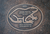
Soon, Twain was writing for California’s most prestigious literary journals, but still earning most of his living with his newspaper reporting. As in Virginia City, Twain had a natural affinity for continually infuriating the local police and judiciary. In San Francisco he attacked them for their lack of honesty and generally cruel treatment of the city’s down trodden. This growing antagonistic relationship finally chased Twain from San Francisco, sending him to a miner’s cabin on Jackass Hill, near Angels Camp. Here, Twain and his longtime friend, Jim Gillis, spent their time, with Twain writing and avoiding most of the arduous drudgery associated with Gillis’s “pocket mining” search for gold. In one of many regular visits to nearby Angels Camp, Twain heard the story of a jumping frog contest, with a competitor's jumping frog being unknowingly weighted down with a couple pounds of lead shot. Twain’s writing wizardry, coupled with lax copyright laws, saw the popular story reprinted across the Unites States, launching his literary career beyond mere journalistic reportage and making his name synonymous with California’s gold country.
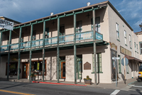
Traveling along the nearly 200 miles of California’s Mother Lode today, most notably near Angels Camp and Sonora where so many of both Mark Twain and Bret Harte’s gold country stories were staged, it is impossible to miss the legacy of either writer. From carved stone statues and bronze historic plaques, to the names of public schools and shopping centers, both have been immortalized. One small community east of Sonora has even taken the name “Twain Harte” in remembrance of the two writers most responsible for capturing the drama, mystique and excitement of an era that was ending even as they came onto the scene. If both were alive today, the two egos certainly would exchange verbal and written barbs over whether the town should be named Twain Harte or Harte Twain.
One can follow the trail of both Harte and Twain’s adventures in the West through their writings, although it is often difficult to decipher where truth ends and literary license begins. Just as difficult, is attempting to identify the exact locales of either writer’s stories. Often their short stories were compilations of characters and locations that two fertile and imaginative minds merged with the license of fiction into nonexistent Gold Rush towns.
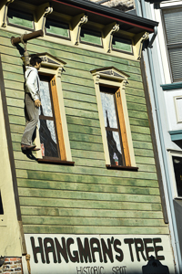
In reality, so many mining camps, such as Butte or Fourth Crossing, sprang to life, only to die a quick and heartless death as their placer claims quickly played out and they vanished from the face of the earth, save for the occasional modern historical marker. Other towns simply changed their names. Pokerville became Plymouth; Dry Diggins became Hangtown, which became Placerville; and a different Dry Diggin’s begot Wood’s Dry Diggin’s, which begot North Fork Dry Diggin’s, which begot Rich Dry Diggins. Today, the town is called Auburn. Certainly there are exceptions to all these name changes, such as in Twain’s Celebrated Jumping Frogs of Calaveras County, which put both the county of Calaveras and the town of Angels Camp permanently on the world map.
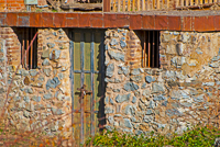
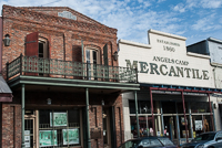
Today, tourists park along historic Highway 49 that passes through Angels Camp. As in nearly all old Gold Rush towns that still exist, shops, restaurants, saloons, and other businesses line covered sidewalks and attract thousands of people each year. Angels Hotel, where Twain heard the initial frog story, remains today, although the historic building now is home for business offices rather than transient gold seekers. On Jackass Hill, between Angels Camp and Sonora, Mark Twain’s cabin has been reconstructed around the original fireplace. And a little closer to Sonora, a monument marks the remnants of the Tuttletown grocery store where Twain traded.
As Mark Twain’s literary popularity continued rising, Bret Harte’s continuing efforts were, more often than not, meeting with failure in this country. Harte left for Europe, finally settling in Camberley England, where he wrote mostly rehashed versions of his earlier California stories. Although Harte’s prominence in the U.S. had long since waned, he remained popular in England until his death in 1902, at the age of 65.
Twain’s most popular novels, such as Roughing It, Tom Sawyer, The Prince and the Pauper, and Adventures of Huckleberry Finn, were written after his departure from California in 1868. In addition to his success as a writer, Twain turned to the lecture circuit, where his wit and wisdom brought him additional fame. Twain’s fame and popularity remained with him until his death in 1910.
Although both writers have long since passed on, their stories remain popular throughout the world, and in their old Gold Rush stomping grounds, the spirit of Mark Twain and Bret Harte is alive and well. Spend much time in California’s Mother Lode and you too, will begin to feel the spirit and excitement of gold fever. But, a word of caution–gold fever is just as contagious today as it was 140 years ago.
Copyright 2015 by Publishing Syndicate, all rights reserved. For permission to reprint text or photos contact Writer@PublishingSyndicate.com


w110
Columbia SHP: Gem
of the Southern Mines
“Gold! Gold!” That was the cry heard in the Sierra Nevada foothills nearly 150 years ago when James Marshall discovered the precious mineral -- over 100,000 people came to the Mother Lode of California in hopes of striking it rich, all crazy for that shiny mineral. Some used their knowledge of geology, most relied on the latest rumor. Little did these prospectors know that the land they worked would come to be worth more than the gold they sought.
To relive this spirit of gold discovery and the great Gold Rush, a visit to the historic town of Columbia is a must. Found in the southern Mother Lode foothills, just two hours east of Stockton, Columbia, a designated California State Historic Park, offers the public a chance to partake in its heyday. Open every day of the year with the exception of Thanksgiving and Christmas Day, Columbia is considered California’s best preserved Gold Rush town. Walking maps and brochures on the town’s history are easily found within the six-square block park, where most streets are absent of any and all motor vehicles. Large parking lots, which can accommodate RVs, are found around the park’s perimeter, though park officials stress that a tow vehicle may be more convenient.
Coined “the Gem of the Southern Mines,” Columbia is a town which seems frozen in time since its discovery nearly 150 years ago. In March of 1850, Dr. Thaddeus Hildreth, his brother George and a few other tag-along miners found gold at the site while camping for the night. As word quickly spread and more prospectors rushed in, the oak and pine-studded land was quickly covered by canvas tents and wooden shanties. Like most Gold Rush towns, Columbia was known by many other names during its history. The strike was originally named Hildreth’s Diggin’s, transformed into American Camp, and finally Columbia, which was the name that stuck.
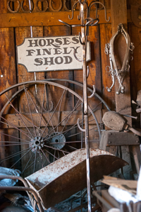
Within a few months, Columbia’s reputation for its riches, along with its population, had surged. At its wealthiest, Columbia’s land produced over $87 million worth of gold (19th century prices) and boasted some 10,000 inhabitants; enterprising merchants made their own fortunes by opening numerous saloons, blacksmith and barber shops, and hardware, drug and grocery stores. The rough and tumble living of these mining communities also required public services such as medical and dental care, assay offices, banks, stagecoach lines and a courthouse.
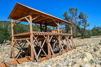
Mining in Columbia was a back breaking job -- considered “dry diggings” as opposed to stream or river panning, miners had to extract gold via hydraulic, or water pressure, mining. The major drawback in trying to make a living in Columbia as a miner was the complete absence of year ‘round flowing streams in the area. Thus, imported water was to become the lifeblood of Columbia.
In 1851, the Toulumne Water Company was formed, and for rates that were worth their weight in gold, the company supplied water to the miners. The high rates eventually brought competition in 1854, when the Stanislaus River Water Company was formed and began construction of a 60-mile aqueduct designed to divert water from the Stanislaus River. Unfortunately for the new company, their million dollar aqueduct wasn’t completed until 1858, just about the same time that Columbia’s richest gold deposits had all but played out.
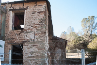
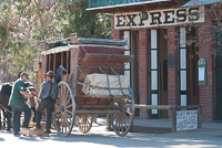
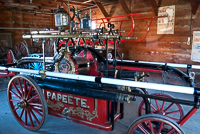
Columbia shared many similarities with other Gold Rush-era towns, but one similarity that the town would have soon lived without was fire. In 1854, and again in 1857, devastating fires swept through the wooden buildings of Columbia, each time destroying much of the town. The move to brick and stone buildings, which is evident today, along with the creation of a volunteer fire department with its acquisition of a new fire engine, put an end to such devastating fires. The two-cylinder, hand-drawn fire engine, named Papeete (Pop-YAY-tay), originally built for the king of the Sandwich Islands, is on display in Columbia’s firehouse when its not out brightening parades and other historic programs in town.
One of the unshared similarities with dozens of communities founded in the Mother Lode is that Columbia never became a ghost town. From the day the good doctor and his brother discovered those first gold nuggets, people have lived here, although in later years the quality of housing increased substantially. Today, over 500 people call Columbia home, some of whom even live within the boundaries of the park. Historic Columbia has been so well preserved that many motion picture companies have taken advantage of the town’s authenticity, filming such movies as Clint Eastwood’s famed Pale Rider.
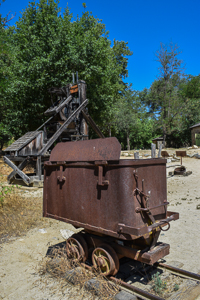
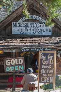
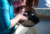
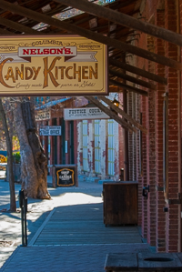
A real Gold Rush town wouldn’t be complete without a chance to “strike it rich.” Several mining concessions operate within the park, offering visitors a chance to try their luck. Plenty of stores and antique shops, filled to the brim with their own golden treasures, are sure to please collectors and window-shoppers alike. And when panning and shopping energy reserves are at their lowest ebb, partake in the delights of the fine restaurants and food vendors and refill those reserves. Of course, the Candy Kitchen is always open for dessert or a quick snack; the business is one of the few in the state to offer fresh made, hand-dipped chocolates, taffy and other candy delights.
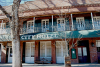
One day generally isn’t enough time to enjoy all that Columbia has to offer, so the City Hotel and Fallon Hotel offer accommodations that are reminiscent of Columbia’s bygone era with amenities today’s travelers expect. The City Hotel also offers a fabulous dining treat in its restaurant, which serves as a training facility for college students who will one day be seeking work in some of the country’s finest eating establishments.
The Columbia Actors Repertory Theater offers a wide variety of plays in the Fallon Theater. For some heart-pounding, hands-on action, ride shotgun atop a stagecoach as it roars down Main Street or take a slower-paced horseback ride through town and into the nearby foothills. Or, stop by the photo shop and have an 1850s photo taken in period dress.
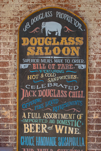
To wash down all that trail dust, mosey into one of the town’s saloons; in its more rambunctious years, over 30 saloons lined the streets of Columbia, boasting the best in gambling and the proverbial “wine, women and song” entertainment. Today, the St. Charles and the Douglass saloons are both open to the public, serving beer, sarsaparilla and other beverages.
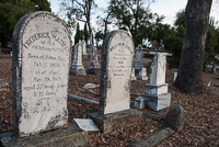
Searching for something a little less sinful than saloons? How about the Church of the 49ers, which is still in use today. The Presbyterian Church, built in 1854, was one of the earliest Protestant churches in the Mother Lode. Unfortunately, Papeete couldn’t save the original, as it burned to the ground in 1950. A replica has been built in its place. At the far north end of town, perched picturesquely on top of a small knoll, a two-story school house still stands that served the children of Colombia from 1860 until 1937. And the Columbia cemetery, which has remained in use since 1855, is also an intriguing place to spend some time wandering about, reading native Columbia marble headstones of those who passed this way a very long time ago.
To gain a complete history of Columbia, visit the town’s museum. Located near the middle of Main Street, this building, as well as the majority of the other buildings in the park, have their own tales to yarn of California’s great Gold Rush.
For more information on Columbia State Historic Park, contact the park office at P.O. Box 151, Columbia, CA 95310, (209) 532-4301. www.parks.ca.gov
Copyright 2015 by Publishing Syndicate, all rights reserved.
For permission to reprint text or photos contact
Ken@PublishingSyndicate.com
Publishing Syndicate
PO Box 607 Orangevale CA 95662
Ken@PublishingSyndicate.com
Copyright 2010-2016 by Publishing Syndicate: All rights reserved